Two weeks ago, my friend Kelley and I went to Joshua Tree National Park for a weekend. I happened to have a lot of down time the day before we left and put together a very detailed itinerary, which is something haven’t done since I started long-term travel back in 2013 — on my longer trips there simply isn’t time to flesh out my travel plans to the letter, so I had to adapt my travel style to become more spontaneous. And truth be told, that is now my preferred way to go. But I’m so glad I had the time to properly research and plan for this Joshua Tree weekend! Since we had a timeline to follow, there was no wasting time debating what to do next; we simply went to the next thing on the list, which was laid out in the most efficient order based on geography within the park. Remarkably, not only did this timeline work out perfectly, but I padded it enough that we often ended up ahead of schedule. So I wanted to share it here, in hopes that it might be useful to other people planning a weekend trip to Joshua Tree.

In the next week or so, I’ll have many more posts that delve specifically into each of the areas mentioned below. But I wanted to put together one big overview post.
I should point out that this itinerary isn’t exclusive to Joshua Tree, as we tacked on a few hours in Palm Springs at the end of our second day — it was the perfect place to get a delicious lunch (there are so many great dining options in Palm Springs) and then squeeze in a bonus hike at a lush oasis area before making the drive back to Los Angeles.
Here’s the itinerary I put together. We departed from the Toluca Lake area (Priscilla’s is my favorite coffee shop and they open at 7am on Saturdays, hence our departure time). If you want to print out this itinerary, you can download the PDF here.


Here’s a link to the Google Map I created for this trip — it’s got the coordinates of literally every place we visited, in the order that we visited them.
And here is a map of the places we visited in Joshua Tree:

And here is the total hiking mileage — I calculated it during my planning session, as I didn’t want to overload one day more than the other. (Worth noting: in reality, we ended up walking 10 miles on Saturday according to Kelley’s Fitbit.)
| SATURDAY: | SUNDAY: |
| Barker Dam Loop (30 min., 1.8 miles, easy) | Cholla Cactus Garden (3 min, .3 miles, easy) |
| Hidden Valley area (30 min., 1 mile, easy) | Arch Rock Campground (1 hour, 1 mile, easy) |
| Ryan Ranch (30 min., 1 mile, easy) | Pine City hike (4 miles, easy) |
| Lost Horse Mine (2 hours, 4 miles, moderate) | Palm Canyon (2 miles, easy) |
| TOTAL = 7.8 miles | TOTAL = 7.3 miles |
TOTAL WEEKEND HIKE MILAGE = 15.1 miles
Kelley suggested that we stop at Hadley Fruit Orchard for a bathroom break en route to Joshua Tree. In addition to all sorts of goodies on offer, Hadley’s is known for their date milkshakes. It was a little too early in the morning for a full milkshake, but the kind woman behind the counter let us try samples of their regular date milkshake and also the banana date milkshake. I don’t know which one I would’ve chosen for a full size because they were both so delicious! I would absolutely go back here again en route to Palm Springs or Joshua Tree (it’s at the same exit where the outlets are) and next time I’ll bring my appetite.

Next up, we stopped at the Joshua Tree National Park Visitor’s Center.

After officially entering the park, we pulled over near Intersection Rock area for some photos en route to our first hike:
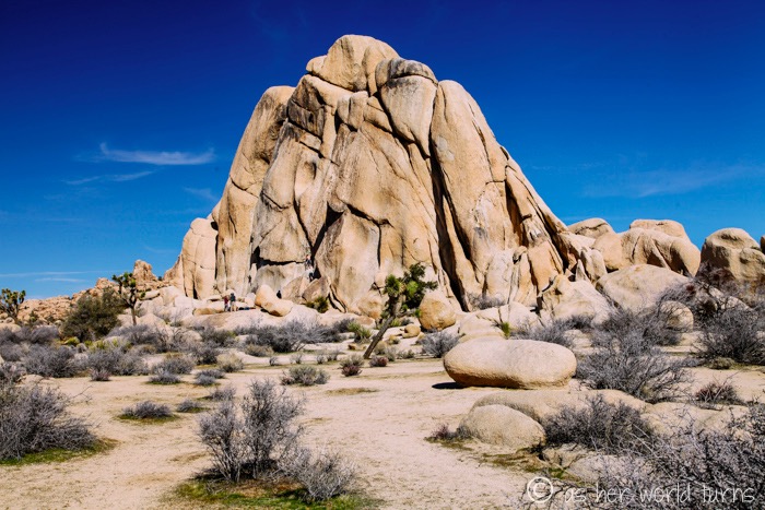

Joshua Tree is a major destination for rock climbers in southern California. We saw evidence of this all over the park:

And we then headed to our first official hike of the morning: Barker Dam Loop.

Kelley’s husband hiked here just a few months ago when the drought was still in full force, and this lake was bone dry! I’m glad we got the reflection in the water as it was especially scenic:


We drove to the Hidden Valley area for a picnic lunch we’d brought with us. There are some really interesting rock formations around the parking lot — to me, this one looks like a mama rodent kissing a baby rodent. Anyone else see that? Like maybe they could be squirrels or chipmunks?

Here is one of thousands of Joshua Trees within the park — it’s remarkable how as soon as you enter, they are EVERYWHERE. And they are such a unique shape.

High-fiving a Joshua Tree!

Next we did the easy Hidden Valley loop hike. Beautiful scenery.


Next we went to Ryan Ranch. We specifically skipped the Ryan Mountain hike, preferring to save our big hike of the day for Lost Horse Mine. So we just walked out and back from this sign to the ranch ruins. It’s a super scenic area and an easy walk.


There were climbers on those rocks:


Those are the remaining walls of Ryan Ranch:

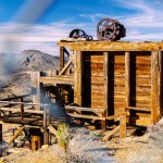
Next we did a more challenging hike (although it was still very manageable — most of the hikes in Joshua Tree are flat and easy, but this one involves some uphills). It’s called Lost Horse Mine and we went out-and-back instead of doing the whole loop. At four miles round-trip, it was great exercise, and the mine at the top is really neat.

Next we drove to Keys View, one of the higher points in the park. We walked around, admired the views, and snapped photos.


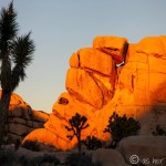
After reading about photography tips for Joshua Tree, we decided to watch sunset from Intersection Rock, where we first stopped in the park (it’s also right across from the Hidden Valley area). The light was spectacularly golden.


After sunset, we left the park and went back to the main drag by the Visitor’s Center. We’d been looking forward to our dinner all day: Pie for the People, a pizza joint. IT WAS SO GOOD.

We spent the night at Safari Motor Inn — including taxes and fees, the total was $65 for the room. Split two ways, that is an excellent deal. It’s a very simple motel but it suited our needs perfectly. We were asleep by 9pm.
The alarm went off at 5am… sunrise was happening at 6:40am, but the sky starts to get light at least 30 minutes before that, and we had to drive 45 minutes just to get to our chosen sunrise location. (We decided to drive the fast way north of the park, instead of meandering through the park at a slower speed.)

We’d picked Cholla Cactus Garden based on a suggestion from that Joshua Tree photography guide I referenced earlier — it recommends being in position at the cactus garden the moment the sun first peaks over the horizon. That turned out to be spot-on advice, as you’ll see in a moment.

The sunrise photo I was seeking. Look at those rays!

The dawn light is so soft at this hour.

From there we drove to Arch Rock Campground, which, for the record, is the number one place I would suggest camping in the park (I’m not sure how permits / reservations work since we didn’t camp). It’s a truly special area.
Within about 5-10 minutes from the parking area is Arch Rock:

There were fortunately only a few other people here at this hour. I imagine this would be less fun to photograph with crowds of people.


Next we stopped by Skull Rock, located just off the side of the road. Can you see the face?

We did a short hike around Skull Rock to admire these views:

Next we set off for our final Joshua Tree hike — called Pine City. It was about 3.8 miles total (it’s an out-and-back hike, so 1.9 miles each way, despite the fact that the signage incorrectly says it’s only one mile).
This appears to be a plain hike — it’s lacking wow factors like a dam or mine or ranch — but every stretch of this trail is gorgeous. Plus we encountered both red and purple cactus here. And there were practically no other people!


We bid adieu to the park and stopped back in town one more time to get coffee from Joshua Tree Coffee Co., which is just behind Pie for the People:


By then it was around noon or so, and we drove to Palm Springs for a proper lunch. We picked Trio, a place I went to with my sister years ago (check out my Palm Springs food guide from that trip), because Trio has a $20 pre-fixe menu that includes a dessert and appetizer. I went with fried artichokes, the Australian sole, and bread pudding.

Stuffed from lunch, we walked off our meal on a bonus hike seven miles south of downtown Palm Springs — this is called Palm Canyon and it’s part of Native American land. Entrance is $9 per person (we had incorrectly assumed that was the cost per vehicle, so it was pricier than expected). My sister hiked here years ago and I remember her photos were very intriguing. It’s a palm tree oasis, all green and lush with a stream running through the grove. The sky was overcast so you’re not getting the full effect in these photos, but it’s quite stunning.


After hiking around here for a bit, we headed back to Los Angeles in record time (this was during the Super Bowl — score!).
Major thanks to Kelley for joining me on this adventure! And for doing all the driving!
As I said, I’ll have more in-depth posts about each hike and place we visited over the next week or so, but I wanted to squeeze all the info into one post to more easily share our itinerary. Hope it’s helpful. Joshua Tree is a remarkable place and it’s only 2.5 hours from Los Angeles — I already can’t wait to go back myself and tackle a few hikes we didn’t have time for, like Lost Palms Oasis and Wonderland Ranch / Wall Street Mill. If it weren’t so cold at night this time of year, I’d enjoy camping, too. And I bet in the coming weeks there will be more wildflowers blooming out there. So many reasons to go back!

Oh man. Like you, I try to keep my travel itineraries flexible to allow for whatever might come up, but your detailed itineraries here speak to my deep-rooted need to organize everything. I love it and am definitely going to bookmark it for the next time I’m in LA. Thanks for posting and love your photos! Can’t wait to read more.
Thank you, Kelsey! You’d love Joshua Tree — there is so much to photograph. I’d been itching to do this trip for a year and am so glad it finally worked out!